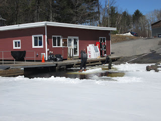
This is the final post for the season. I was into town today by boat for the first time this year and found no ice on Five Mile Bay and Seven Mile Bay. These two photos show a wind blown Five Mile Bay. Taken Apr. 27/19
This shows the channel at Beauty Island and Looking toward the Bear Head. No ice visible. Taken Apr.27/19
This shows a plug of ice between Gash and Lent Islands. It should be gone in about a day. I did find about 200' of ice in the end of Redner Bay. Taken Apr.27/19
Saturday 27 April 2019
Thursday 25 April 2019
Wednesday 24 April 2019
This is on Seven Mile Bay heading into town approaching Milton Is. It is mostly ice free except for the northeast corner. Taken Apr.24/19
This shows Five Mile Bay at the Osprey nest. Taken Apr.24/19
Dunroe up ahead. Taken Apr.24/19
Approaching Three Mile Point on the way into town at around 11:00 am. Taken Apr.24/19
Approaching Three Mile Point on the way out at 3:30 pm. Quite a bit more open water in a few hours.
Taken on Five Mile Bay at Dunroe Island. This is candle ice about 6" thick. The scoot was breaking through most of the way. It should be gone within a few days. Taken Apr.24/19
Back home on Kineras Bay. This is 4" candle ice and will probably be gone tomorrow. The white ice will drift off and gradually melt away. It can drift to block channels making for a difficult passage. Taken Apr.24/19
Sunday 21 April 2019
Wednesday 17 April 2019
Todays satelite photo show the ice slowly reducing. Taken Apr.17/19
https://coastwatch.glerl.noaa.gov/modis/modis.php?region=h&page=1
https://coastwatch.glerl.noaa.gov/modis/modis.php?region=h&page=1
Tuesday 16 April 2019
Aproaching Seven Mile Narrows on my weekly trip into town. Taken Apr.16/19
The entrance to Seven Mile Bay. Taken Apr.16/19
The Osprey nest at the entrance to Five Mile Bay. Taken Apr.16/19
I stopped here in the middle of Five Mile Bay to drill for the ice thickness. It is more than 16" thick ( the length of my drill) with 8" of that being black ice. Taken Apr.16/19
The entrance to the Menominee Channel. Taken Apr.16/19
Approaching Three Mile Point. Taken Apr.16/19
Approaching the Two Mile Narrows. Some of the marinas have started launching boats. I saw one out checking the ice. It's going to be a couple more weeks until the south channel is navigable. Taken Apr.16/19
Anchor Island near Devils Elbow. Taken Apr.16/19
Thursday 11 April 2019
Yesterdays satellite photo of Georgian Bay shows receding lake ice. Taken Apr.10/19
https://coastwatch.glerl.noaa.gov/modis/modis.php?region=h&page=1
https://coastwatch.glerl.noaa.gov/modis/modis.php?region=h&page=1
Wednesday 10 April 2019
I was into town by Scoot today for the first time this spring. There is still a lot of thick ice that will take between two and three weeks to melt. Taken Apr.10/19
Still 24" of ice around the docks at Point Pleasant Marina. Taken Apr.10/19
The snowmobile route at the north end of Isabel Is. is just floating slush that the scoot broke through. Taken Apr.10/19
Looking west toward the range on Dunroe Is. on Five Mile Bay. Taken Apr.10/19
There is an Osprey on the nest. Taken Apr.10/19
Seven Mile Bay. Taken Apr.10/19
The entrance to Seven Mile Narrows. Taken Apr.10/19
Subscribe to:
Posts (Atom)


